SuperTrans is a matlab based computer program that can convert coordinates from one coordinate system to another. The basis of this system is the EPSG Geodetic Parameter Dataset, which contains a lot of coordinate system definitions. The EPSG database is freely available at http://www.epsg-registry.org/.
The program is capable of the following:
- convert between geographic (lat/lon) coordinate systems;
- convert between projected coordinate systems;
- convert between projected and geographic coordinate systems;
- conversion of single coordinates (*.ldb, *.pol, *.xyz, *.grd)
- conversion of files.

SuperTrans can be downloaded below.
Note1: This application requires the installation of the Matlab Compiler Runtime (MCR) v7.11 on your system. The MCR installer can be downloaded here. Please save the executable first (for example in c:\temp), before running it. Download and run the installer before installing SuperTrans.
Note2: Running the application on Windows 7 may give you the following error message (shown for DelftDashboard):
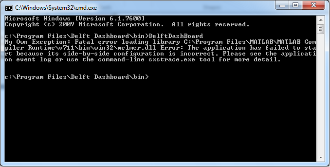
In this case you first need to install the vc redistributables below. Please save the redistributables first (for example in c:\temp) and consequently run the 2005 and 2008 versions (in this order). You may have to restart your pc to activate changes.
Manual
The manual of SuperTrans can be found here.
Tutorial
For the use of the graphical user interface, check the video tutorial below.
This page facilitates the feedback of the users of SuperTrans.
Bugs
Bugs can reported via the issue-management system at http://issues.openearth.nl.
Forum
At the SuperTrans forum you can post questions and remarks or start a discussion.