...
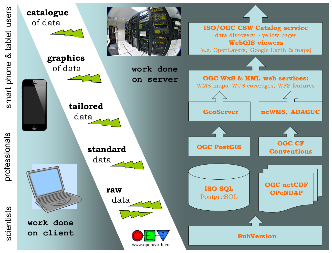
To support the data collection procedure with software tools, the following architecture is used. This architecture uses the general client-server approach from the OGC where catalog web services link to distributed web services providing the data in WCS/WFS for grid/vector data respectively and WFS/WMS for grid/vector graphics. For graphics we also encourage KML (aka Google Earth feed) which can handle both grid and vector data. In addition to these high-level tailoring services, we propose to offer web services for plain standard data (RDBMS with geo-extension or netCDF-CF-OPeNDAP). Finally, we propose to use web services for raw data + tools as well. Here we propose a transactional protocol (meaning that users can also add data) that naturally includes version control. Allowing for sharing of non-standardized data is an important first step in the 5-star model of Tim Berners-Lee. It is often an essential step since some data require significant investment to standardize (2nd star) to open standards (3rd star).
Extraction
Gathering data
...
- Look up the url (web address) where the public available data sets can be downloaded.
- Fill in the inspire metadata editor save the resulting file in https://svn.oss.deltares.nl/repos/openearthrawdata/trunk/organization/your_dataset_title/inspire_description.xml.
- If the dataset is not archived it may be necessary to make a local cache.
...