- Poster Airborne Geophysics: a powerful tool to start up fresh groundwater management in the coastal zone
download
- Faneca Sànchez, M., Gunnink, J., van Baaren, E.S., Oude Essink, G.H.P., Elderhorst, W., de Louw, P.G.B., Siemon, B., Auken, E. Modelling climate change effects on a Dutch coastal groundwater system using airborne Electro Magnetic measurements, Hydrol. Earth Syst. Sci. Discuss., 9, 6135-6184, 2012.
link to HESS
- Presentation (Dutch) Effecten van klimaatverandering op het kustnabije grondwatersysteem van Noord-Fryslân
download
- Animation:
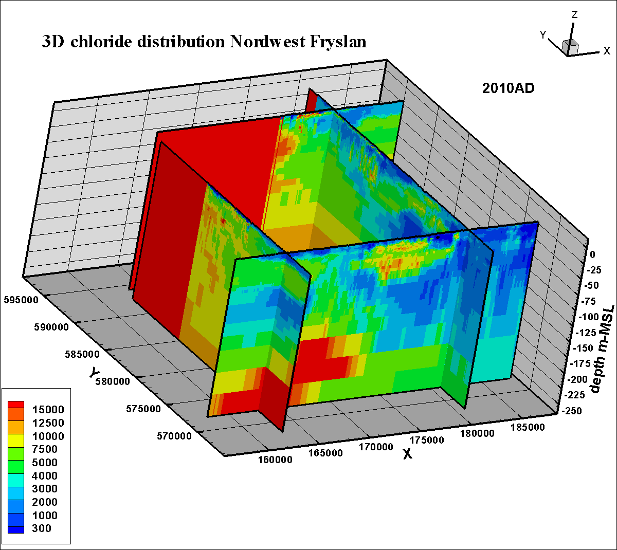
Friesland 3D fresh-saline distribution
| ||
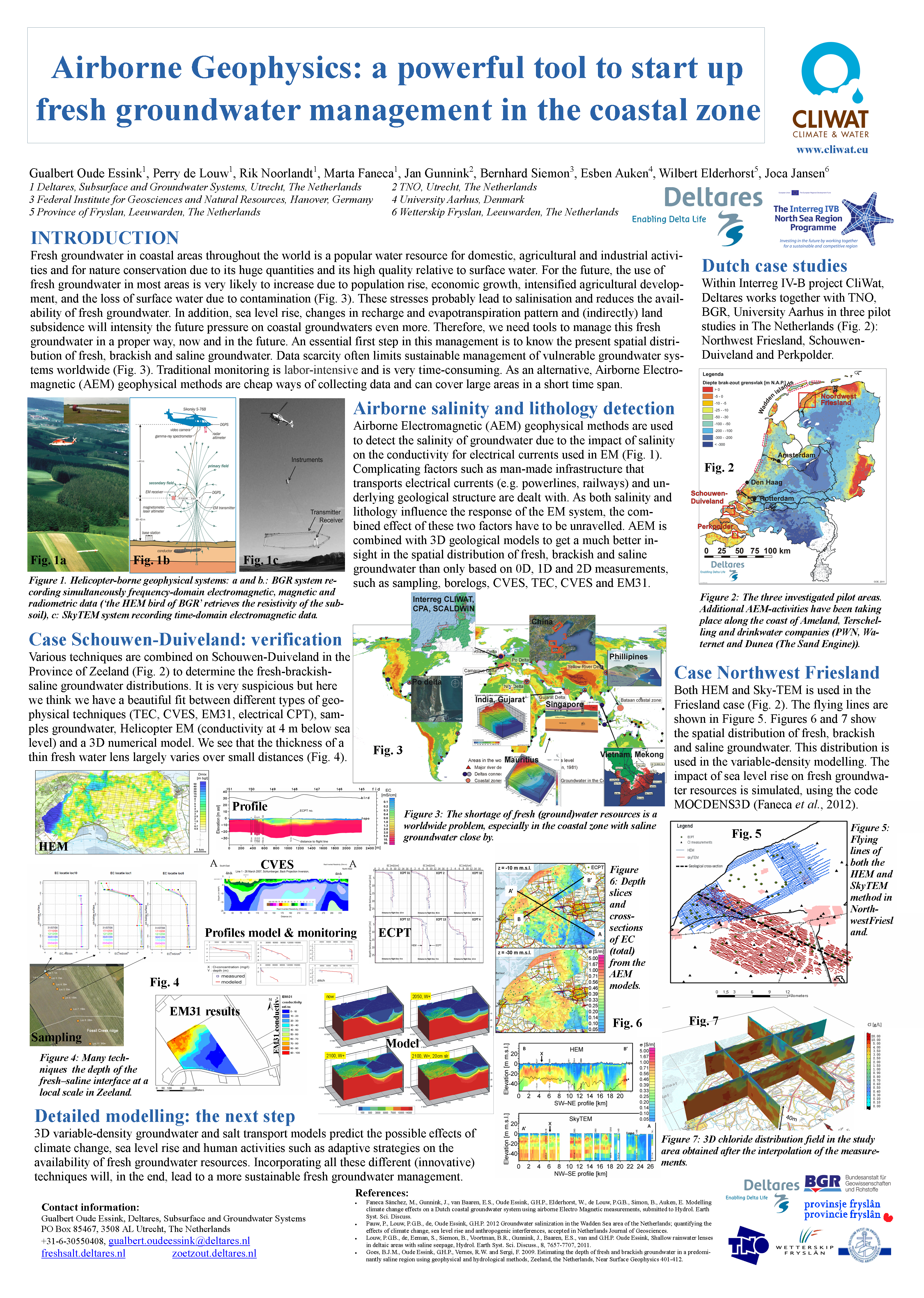
Fresh groundwater in coastal areas throughout the world is a popular water resource for domestic, agricultural and industrial activities due to the availability of huge quantities and its high quality relative to surface water. For the future, the use of fresh groundwater resources is very likely to increase due to population rise (especially in megacities), economic growth, intensified agricultural development, and the loss of surface water due to contamination. The negative effects of salinisation is detected in the exploitation of groundwater for drinking water purposes and groundwater for agricultural use and nature conservation. In addition, sea level rise and the associated changes in recharge and evapotranspiration pattern will intensity the pressure on this coastal groundwater. | |
...
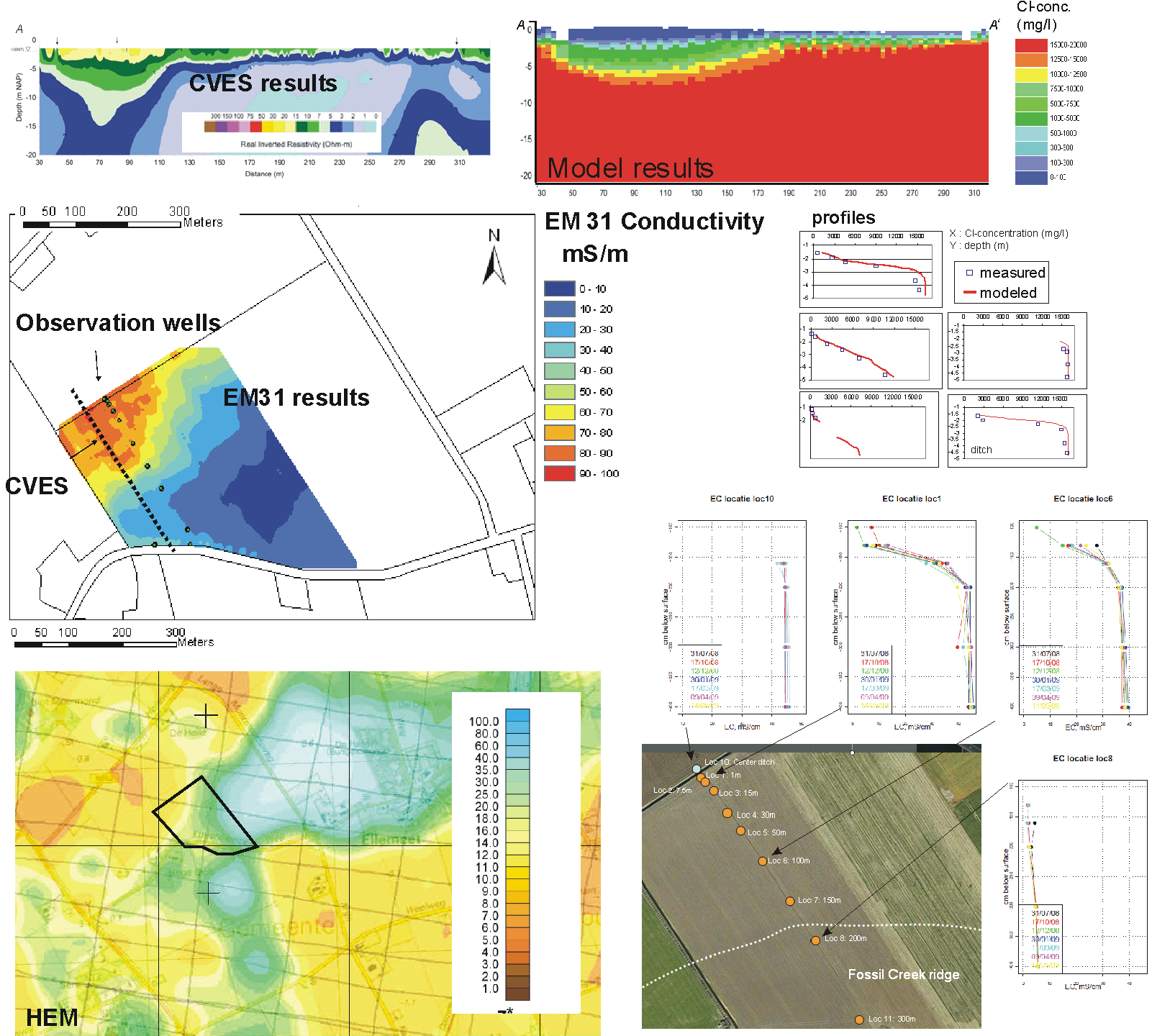
Deltares works together with institutes such as TNO, BGR, Aarhus Geophysics and Fugro to make these AEM methods suitable and accessible for stakeholders for mapping fresh groundwater resources over large areas. Pilot studies in The Netherlands, Denmark and Germany within the framework of the Interreg IV-B project CliWat have been set up to combine Airborne EM results with detailed 3D geological models to get a much better insight in the spatial distribution of saline groundwater as well as in the geological setting. | |
- Poster Airborne Geophysics: a powerful tool to start up fresh groundwater management in the coastal zone
download
- Faneca Sànchez, M., Gunnink, J., van Baaren, E.S., Oude Essink, G.H.P., Elderhorst, W., de Louw, P.G.B., Siemon, B., Auken, E. Modelling climate change effects on a Dutch coastal groundwater system using airborne Electro Magnetic measurements, Hydrol. Earth Syst. Sci. Discuss., 9, 6135-6184, 2012.
link to HESS
- Presentation (Dutch) Effecten van klimaatverandering op het kustnabije grondwatersysteem van Noord-Fryslân
download
- Animation:
Friesland 3D fresh-saline distribution
Information: gualbert.oudeessink@deltares.nl, perry.delouw@deltares.nl or jan.gunnink@tno.nl