Geonetwork is an open source implementation of the OGC CSW (Catalogue Service for the Web) to enable dataset discovery in a thematic way (by keywords) and/or geographical way (by providing coordinates or drawing a rectangle over the place of interest).
Step by step guide
- login with your credentials

click on contribute- After contribute a new screen appears where Add new record should be selected to create a new metadata record.

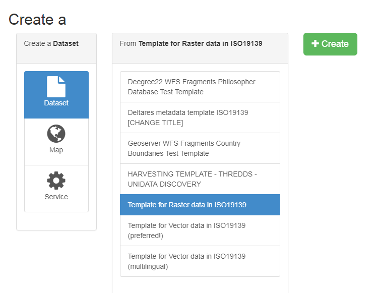
- depending on your type of data (vector or raster) select template for Raster data or template for vector data, if applicable choose the preferred one. In the picture below the template for raster data is chosen.
- Press create button (the green one, green is good!!!) and following screen will appear
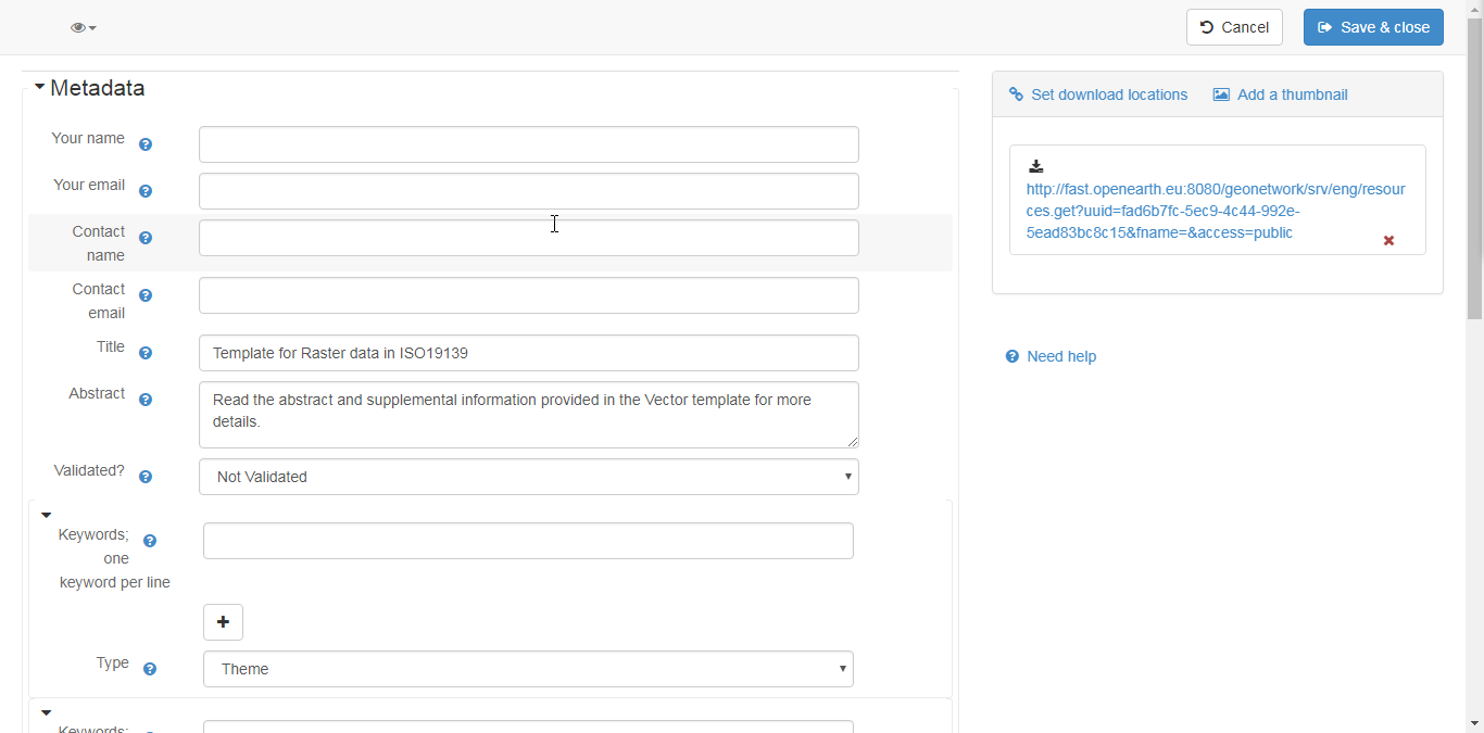
- Now various more ore less obvious actions can be made. Start with the removal of the hyperlink information on the right (below the set download links). Follow with the rest of the metadata. Bear in mind this is a selection of some of the many fields there are. If you want more, you see the small eye in the top left corner. You can press it and then select the second option (which I can not see, but it says, full, meaning the full metadata). Here all the metadata can be filled.
- Now there is a chicken and egg story. I guess you would like to set the download locations. These can be of various kind, but you would like to have the geoserver link like fast.openearth.eu/geoserver. The data set should be there. Ask the FAST core team to make the layer availalbe. But you can already add all the metadata necessary.
- Press save & close. Here you return to the contribute screen like in step 3.
- Now it becomes a bit strange (from a users point of view). To 'unlock' or publish the metadata to be discovered an additional action is required. For every metadata record there is a locker sign on the right, this should be opened. Several ways to do this, the most straight forwoard way is to click on the locker icon. This opens up following screen.

- select all options (take the most rigth select boxes to select all boxes)
- if preferred a screenshot can be added to the metadata (check the options in step 5).
- Beside a geoserver link also links to other locations can be used (for instance a link to the open data website of UK https://data.gov.uk/) if applicable of course, or a link to an online document.
- get in contact with the FAST data admin to get the data in the MI-SAFE tool.