Manually sorted list of Tech Notes (OpenEarth and external links)
Acknowledgements
These tech note have been made by the Data and Knowledge Management section of the Building with Nature programme as a Deliverable of Workpackage DM 1.1
PostgreSQL is the world's most advanced open source ORDBMS (Object Relational Database Management System). It is used in many open source geospatial systems. OpenEarth has chosen PostgreSQL to be on of the two pillars for distributing standardized dtaa, in addition to a netCDF-CF-OPeNDAP stack for large collections of gridded data (BLOBS - Binary Large OBjects) for which ORDBMS are not optimized (e.g. decades of satellite imagery or terabytes of output from numerical models, see these examples). In fact,
- Using a database
- Launching and filling a database
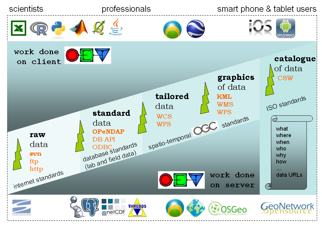
These PostgreSQL/PostGIS standards are an important part of the suite of layered standards OpenEarth identified. PostgreSQL/PostGIS provides standard data for relational data. For the full user range they need to be accompanied though by standards for exchange of grid/vector data data (netCDF-CF-OPeNDAP), for raw data (subversion), and for tailored data, graphics of data and catalogs of data. Geoserver and geonetwork allow for easy coupling of PostgreSQL/PostGIS to WxS services.
Automatic tree of OpenEarth Tech Notes