| Name | Size | Creator | Creation Date | Labels | Comment | ||
|---|---|---|---|---|---|---|---|
| Multimedia File scotertjers.avi | 2.29 MB | Gerrit Hendriksen | 25-03-2013 08:04 |
|
Animation of observations of common scoters in Voordelta (PMR-NCV project Deltares) | ||
| Version 1 (current) | 2.29 MB | Gerrit Hendriksen | 25-03-2013 08:04 | Animation of observations of common scoters in Voordelta (PMR-NCV project Deltares) | |||
| PNG File kusthoogte_vlieglijnen_eems_dollard.png | 1.03 MB | Gerben de Boer | 15-01-2013 23:44 |
|
Rijkswaterstaat kusthoogte lidar data with its airplane tracks (Ems-Dollard) | ||
| Version 1 (current) | 1.03 MB | Gerben de Boer | 15-01-2013 23:44 | Rijkswaterstaat kusthoogte lidar data with its airplane tracks (Ems-Dollard) | |||
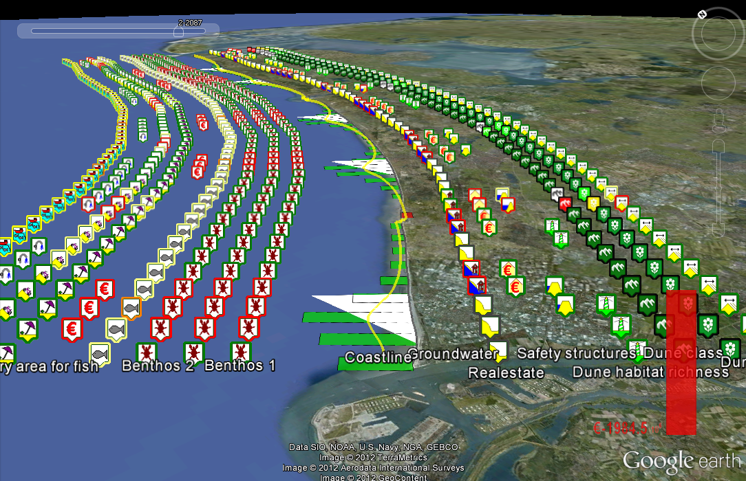
| PNG File ITHK_coastal_indicators (BwN HK4.1, Bas Huisman, 2012).png | 989 kB | Bas Huisman | 24-08-2012 12:09 |
|
Overview of coastal indicators, Bas Huisman, framework of BwN HK4.1 and HK3.8 | ||
| Version 1 (current) | 989 kB | Bas Huisman | 24-08-2012 12:09 | Overview of coastal indicators, Bas Huisman, framework of BwN HK4.1 and HK3.8 | |||
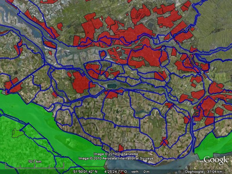
| PNG File gallery_rotterdameo.png | 982 kB | Gerben de Boer | 06-04-2010 11:55 |
|
Dijkringen, residential areas and habitat areas in larger Rotterdam area | ||
| Version 1 (current) | 982 kB | Gerben de Boer | 06-04-2010 11:55 | Dijkringen, residential areas and habitat areas in larger Rotterdam area | |||
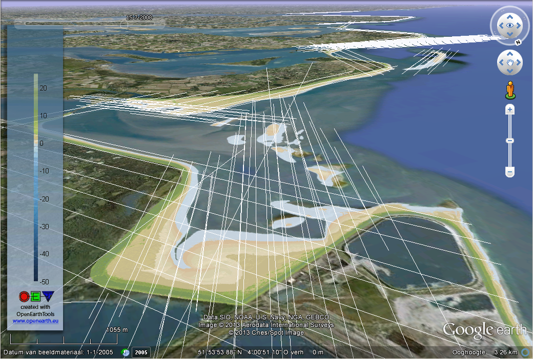
| PNG File kusthoogte_vlieglijnen_voordelta.png | 969 kB | Gerben de Boer | 15-01-2013 23:44 |
|
Rijkswaterstaat kusthoogte lidar data with its airplane tracks (Voordelta) | ||
| Version 1 (current) | 969 kB | Gerben de Boer | 15-01-2013 23:44 | Rijkswaterstaat kusthoogte lidar data with its airplane tracks (Voordelta) | |||
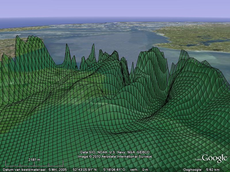
| PNG File KMLmesh_test.png | 914 kB | Gerben de Boer | 15-03-2010 18:49 |
|
3D mesh of faux data "christo" | ||
| Version 1 (current) | 914 kB | Gerben de Boer | 15-03-2010 18:49 | 3D mesh of faux data "christo" | |||
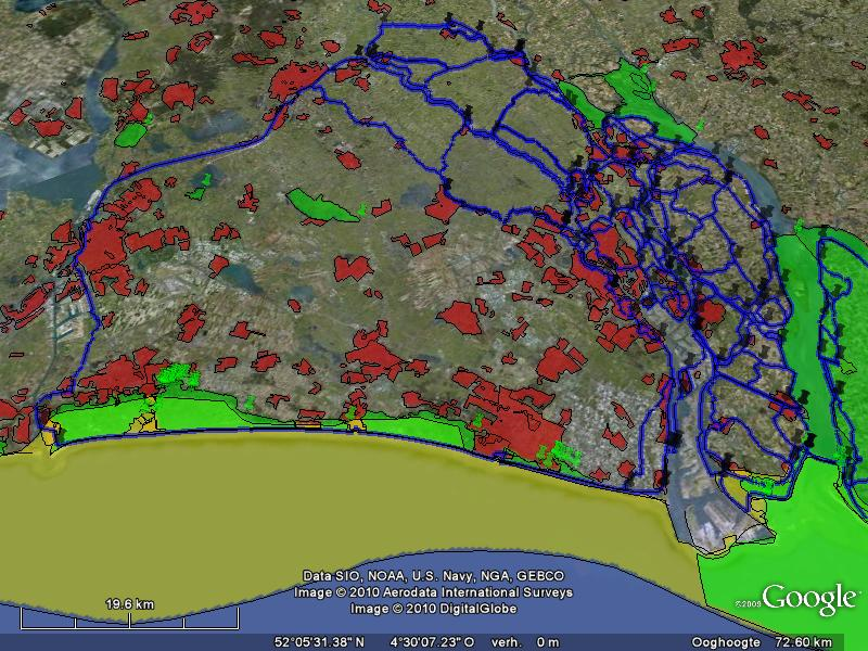
| PNG File gallery_dijkring14.png | 891 kB | Gerben de Boer | 06-04-2010 11:54 |
|
Dijkring 14 with residential areas and habitat areas and kustfundament | ||
| Version 1 (current) | 891 kB | Gerben de Boer | 06-04-2010 11:54 | Dijkring 14 with residential areas and habitat areas and kustfundament | |||
| PNG File Markermeer_krabbersgat_delft3d.png | 890 kB | Gerben de Boer | 15-03-2010 17:57 |
|
Deltares Delft3D bathymetry of Markermeer | ||
| Version 1 (current) | 890 kB | Gerben de Boer | 15-03-2010 17:57 | Deltares Delft3D bathymetry of Markermeer | |||
| PNG File 100 y WS_800x600.png | 877 kB | Gerben de Boer | 03-06-2010 12:10 |
|
Delft3D modeling results after 100 yrs of bathymetric development in Western Scheldt starting from an initially flat bed based on 1998 sediment volume. Mick van der Wegen, UNESCO-IHE. | ||
| Version 1 (current) | 877 kB | Gerben de Boer | 03-06-2010 12:10 | Delft3D modeling results after 100 yrs of bathymetric development in Western Scheldt starting from an initially flat bed based on 1998 sediment volume. Mick van der Wegen, UNESCO-IHE. | |||
| PNG File 200y WS WS_800x600.png | 876 kB | Gerben de Boer | 03-06-2010 12:10 |
|
Delft3D modeling results after 200 yrs of bathymetric development in Western Scheldt starting from an initially flat bed based on 1998 sediment volume. Mick van der Wegen, UNESCO-IHE. | ||
| Version 1 (current) | 876 kB | Gerben de Boer | 03-06-2010 12:10 | Delft3D modeling results after 200 yrs of bathymetric development in Western Scheldt starting from an initially flat bed based on 1998 sediment volume. Mick van der Wegen, UNESCO-IHE. | |||
| PNG File 50y WS_800x600.png | 872 kB | Gerben de Boer | 03-06-2010 12:10 |
|
Delft3D modeling results after 50 yrs of bathymetric development in Western Scheldt starting from an initially flat bed based on 1998 sediment volume. Mick van der Wegen, UNESCO-IHE. | ||
| Version 1 (current) | 872 kB | Gerben de Boer | 03-06-2010 12:10 | Delft3D modeling results after 50 yrs of bathymetric development in Western Scheldt starting from an initially flat bed based on 1998 sediment volume. Mick van der Wegen, UNESCO-IHE. | |||
| PNG File 25y WS_800x600.png | 857 kB | Gerben de Boer | 03-06-2010 12:09 |
|
Delft3D modeling results after 25 yrs of bathymetric development in Western Scheldt starting from an initially flat bed based on 1998 sediment volume. Mick van der Wegen, UNESCO-IHE. | ||
| Version 1 (current) | 857 kB | Gerben de Boer | 03-06-2010 12:09 | Delft3D modeling results after 25 yrs of bathymetric development in Western Scheldt starting from an initially flat bed based on 1998 sediment volume. Mick van der Wegen, UNESCO-IHE. | |||
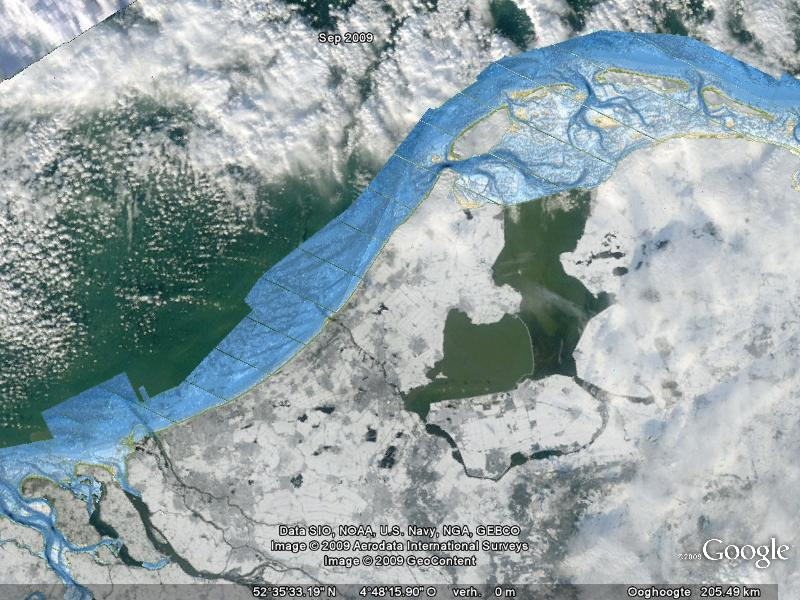
| PNG File vaklodingen_and_MODIS_snow_onearth.jpl.nasa.gov_2009dec22.png | 829 kB | Gerben de Boer | 23-12-2009 14:02 |
|
NASA MODIS image of 2009 Dec 22nd [http://onearth.jpl.nasa.gov] & Rijkswaterstaat vaklodingen | ||
| Version 1 (current) | 829 kB | Gerben de Boer | 23-12-2009 14:02 | NASA MODIS image of 2009 Dec 22nd [http://onearth.jpl.nasa.gov] & Rijkswaterstaat vaklodingen | |||
| PNG File ices_salt_2009_2010b.png | 820 kB | Gerben de Boer | 04-12-2013 23:10 |
|
ICES 2009 salinity obtained with OET tool getICESdata.m from SOAP service http://ocean.ices.dk/webservices/hydchem.asmx | ||
| Version 1 (current) | 820 kB | Gerben de Boer | 04-12-2013 23:10 | ICES 2009 salinity obtained with OET tool getICESdata.m from SOAP service http://ocean.ices.dk/webservices/hydchem.asmx | |||
| PNG File Banjaard.png | 760 kB | Gerben de Boer | 31-08-2010 15:15 |
|
RWS JarKus and coastlines at Banjaard location, Zeeland | ||
| Version 1 (current) | 760 kB | Gerben de Boer | 31-08-2010 15:15 | RWS JarKus and coastlines at Banjaard location, Zeeland | |||
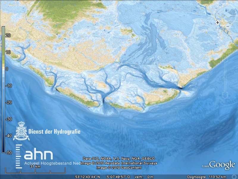
| PNG File bathy200mgrid_screenshot5.png | 746 kB | Gerben de Boer | 05-07-2010 16:12 |
|
Netherlands Hydrographic Office sea bathymetry & AHN land elevation | ||
| Version 1 (current) | 746 kB | Gerben de Boer | 05-07-2010 16:12 | Netherlands Hydrographic Office sea bathymetry & AHN land elevation | |||
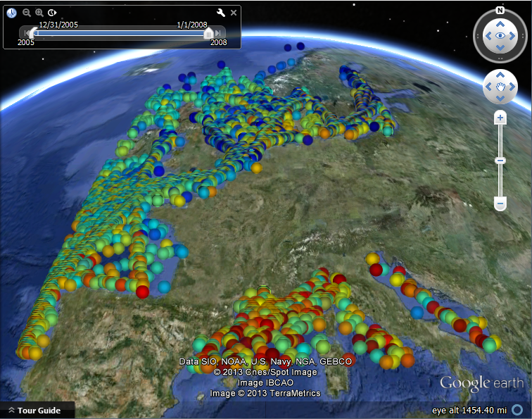
| PNG File VOS.png | 742 kB | Gerben de Boer | 07-06-2013 11:48 |
|
Vessels of Opportunity temperature data | ||
| Version 1 (current) | 742 kB | Gerben de Boer | 07-06-2013 11:48 | Vessels of Opportunity temperature data | |||
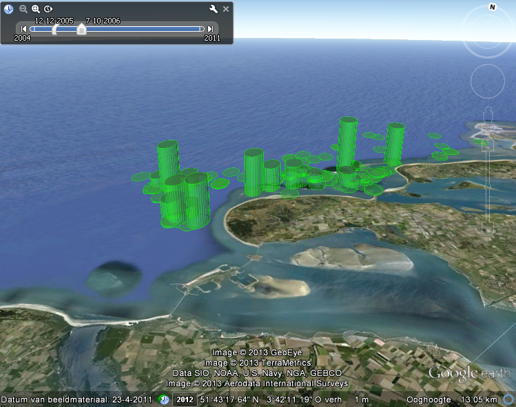
| PNG File kustviewer_eendjes.png | 732 kB | Gerrit Hendriksen | 25-03-2013 08:02 |
|
Observations of common scoters near Voordelta (PMR-NCV project Deltares) | ||
| Version 1 (current) | 732 kB | Gerrit Hendriksen | 25-03-2013 08:02 | Observations of common scoters near Voordelta (PMR-NCV project Deltares) | |||
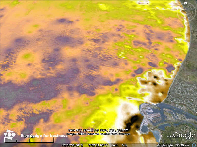
| PNG File dz10_juli2007_screenshot1.png | 716 kB | Gerben de Boer | 09-06-2010 12:45 |
|
TNO Bouw en Ondergrond sediment data (D10) van Dutch Continental Shelf | ||
| Version 1 (current) | 716 kB | Gerben de Boer | 09-06-2010 12:45 | TNO Bouw en Ondergrond sediment data (D10) van Dutch Continental Shelf | |||
| PNG File dz50_juli2007_screenshot2.png | 713 kB | Gerben de Boer | 09-06-2010 12:45 |
|
TNO Bouw en Ondergrond sediment data (D50) van Dutch Continental Shelf | ||
| Version 1 (current) | 713 kB | Gerben de Boer | 09-06-2010 12:45 | TNO Bouw en Ondergrond sediment data (D50) van Dutch Continental Shelf |