...
The available request methods with their supported parameters are described here.
GetCapabilties
GetCapabilities: get the available layers and times available for each layer at the current system time. GetCapabilties will return its content as XML by default. A json format is supported as well, which is more convenient for web development.
GetMap
GetMap: Get the plot image as png for a layer for a requested time, image size and extent. Only untiled images are supported, which means the complete image has to be requested for the complete extent.
Request
...
parameters
- LAYERS (string): id of the gridPlot that should be rendered. Only one id is allowed.
documentVersion (string): File format version.
Supported parameters:
- LAYERS (required): the layerId of the plot to display. Only one layerid is supported.
- TIME (required): the time for which the grid has to be plotted. Only one time is supported. Time ranges are NOT supported. Time has to be
- WIDTH (optional): width of the image. Default is 800.
- HEIGHT (optional): height of the image. Default is 600
- VERSION (optional): supported version is 1.3 and is the default if not set. Older versions might work, but are not supported
- CRS (required): the output projection of the plot. Only supported projection is: EPSG:3857
- BBOX (required): the bounding box (in the projection as defined by the SRS parameter) of the extent that should be plot
Supported vendor parameters:
- SHOWCONTOURS (optional): Display contour lines if enabled in the gridplot. Default is false. Set to true to show contour lines.
...
Restrictions:
- The product of width and height is limited to the full HD resolution of 1920x1200 to avoid memory issues. In case a GetMap request is done where WIDTH*HEIGHT > 2304000 a bad request error will be returned.
Response
PNG image of the requested gridPlot for the specified timeStep.
Example request
| Code Block |
|---|
"http://localhost:8080/FewsWebServices/wms?request=GetMap&version=1.1.1&layers=giss_e2_h_grid%20decennially%201time=1859-01-01T00%3A00%3A00.000Z&srs=EPSG%3A3857&width=920&height=500&bbox=-17885041.62627868,-6887893.4928338025,18119856.177170746,12679985.748171324"
|
Example XML response
| Code Block |
|---|
<?xml version="1.0" encoding="UTF-8"?>
|
Example JSON response
| Code Block |
|---|
<?xml version="1.0" encoding="UTF-8"?>
|
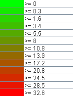
GetLegendGraphic
GetLegendGraphic: Get the legend image as png for a layer.
Properties
The following WMS specific properties can be configured in the FewsPiService.properties file.
...