...
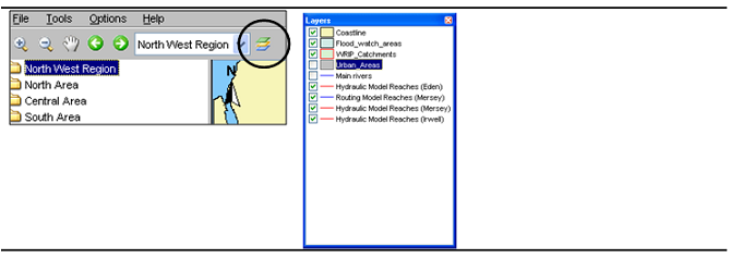
Locations are displayed on top of the background map. The selected main filter determines which locations will be displayed. The background map may be configured to consist of stacked layering of various maps. For each map details about line types and fill colours may be set as well. Map layers can be disabled via the Layers button on the Button Bar..
Tooptip
Information that is displayed when the user is moving the mouse cursor over a shape. To see this information turn on the 'I' button, in the button bar.
Map navigation
Map navigation options are set in the zoom toolbar item. After clicking the '+' button you can manually zoom in to a user defined map area. With the '-' button you can zoom out. Panning is possible after having clicked the hand button. Returning and moving forward between previously selected zoom extents can be done after clicking the arrow buttons. The drop-down allows you to select pre-defined zoom ranges.
...