...
Geo datum used to calculate the distances in meters between the points. To calculate distances efficiently and to pre-sort the input points in a grid the earth's curved surface should be transformed to a flat two-dimensional surface. When the input geometry is not in meters calculation of distances will be very slow and a search all is required when there is no exact match. When there is no region/country specific coordinate system available choose a utm zone that best fits with your output region. http://en.wikipedia.org/wiki/File:Utm-zones.jpg. eg. UTM55S for Victoria state in Australia. Only use zone number and N for northern hemisphere and S for southern hemisphere
Functionality
For every timeatep, this transformation will query the locations that have a value. Locations where the current value is missing, will be ignored. Using the selected stations a network of Thiessen polygons is calculated. Each polygon is given the value of the related location. In the next processing step, the polygons are overlayed on the output locationSet. This can be polygons (eg subcatchments), but also a grid and scalar locations.
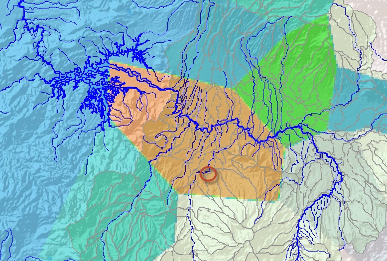
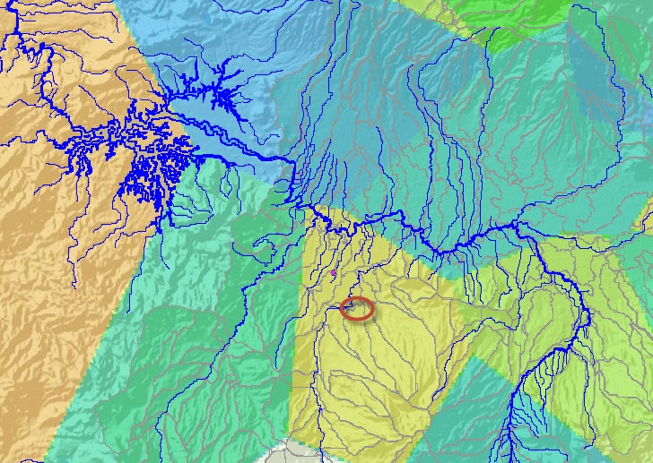
The location at the circle has a value for this timestep and accordinaly a Thiessen polygon is calculated for this station |
in this timestep there is no value for the station, and thus the Thiessen polygons are only drawn for the stations with values |
|---|
Output
- outputVariable (data for polygons)
Configuration example
| Code Block | ||
|---|---|---|
| ||
<?xml version="1.0" encoding="UTF-8"?>
<transformationModule version="1.0" xmlns="http://www.wldelft.nl/fews" xmlns:xsi="http://www.w3.org/2001/XMLSchema-instance" xsi:schemaLocation="http://www.wldelft.nl/fews http://fews.wldelft.nl/schemas/version1.0/transformationModule.xsd">
	<!--rainfall-->
	<variable>
		<variableId>Rain_Gauge</variableId>
		<timeSeriesSet>
			<moduleInstanceId>ImportTelemetry</moduleInstanceId>
			<valueType>scalar</valueType>
			<parameterId>P.obs</parameterId>
			<locationSetId>precipitation</locationSetId>
			<timeSeriesType>external historical</timeSeriesType>
			<timeStep id="daily0930"/>
			<relativeViewPeriod unit="day" start="-10" end="0" startOverrulable="true"/>
			<readWriteMode>read only</readWriteMode>
		</timeSeriesSet>
	</variable>
	<variable>
		<variableId>Rain_Basin</variableId>
		<timeSeriesSet>
			<moduleInstanceId>HEC_HMS_Sittoung_Update_Pre</moduleInstanceId>
			<valueType>scalar</valueType>
			<parameterId>P.sim</parameterId>
			<locationSetId>SubBasin</locationSetId>
			<timeSeriesType>simulated historical</timeSeriesType>
			<timeStep id="daily0930"/>
			<relativeViewPeriod unit="day" start="-10" end="0" startOverrulable="true"/>
			<readWriteMode>add originals</readWriteMode>
			<!--<delay unit="minute" multiplier="30"/>-->
		</timeSeriesSet>
	</variable>
	<transformation id="SpatialInterpolation_Rain">
		<interpolationSpatial>
			<thiessenPolygon>
				<inputVariable>
					<variableId>Rain_Gauge</variableId>
				</inputVariable>
				<distanceGeoDatum>UTM46N</distanceGeoDatum>
				<outputVariable>
					<variableId>Rain_Basin</variableId>
				</outputVariable>
			</thiessenPolygon>
		</interpolationSpatial>
	</transformation>
</transformationModule> |
...