...
- Follow steps 1 - 7 of Tutorial: Creating a <receptor>.txt file
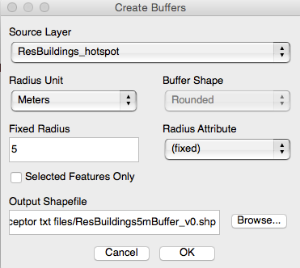
- Create a buffer (e.g. 5m) around each receptor (MMQGIS -> Create -> Create Buffers)
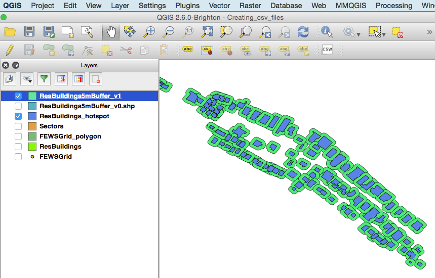
- Subtract the original receptor polygons from the new buffer layer to obtain rings around the receptor (Vector -> Geoprocessing Tools -> Difference). The resulting layer contains (potentially overlapping) buffer rings, each associated with their unique receptorID and areaID of the receptor it originates from. (Step 2 and 3 can be repeated to obtain additional buffer rings, e.g. one with 5m - 10m distance from the receptor)
- Use this layer to proceed with steps 7 - 9 of Tutorial: Creating a <receptor>.txt file. Note that the filename needs to correspond to the second part of the ID of an Hnode, e.g. a file ResBuildings5mBuffer.txt links to a Hnode whose ID ends with "_ResBuildings5mBuffer". In contrast to "real" receptors, the filename does not correspond to an Rnode ID, because latent receptors do not have their own Rnodes, but make use of the Rnode of the corresponding "real" receptor.