...
Deltares works together with institutes such as TNO, BGR, Aarhus Geophysics and Fugro to make these AEM methods suitable and accessible for stakeholders for mapping fresh groundwater resources over large areas. Pilot studies in The Netherlands, Denmark and Germany within the framework of the Interreg IV-B project CliWat have been set up to combine Airborne EM results with detailed 3D geological models to get a much better insight in the spatial distribution of saline groundwater as well as in the geological setting.
Subsequently, 3D variable-density groundwater and coupled salt transport models use these salinity data to more accurately predict the possible effects of climate change, sea level rise and human activities on the availability of fresh groundwater resources (Fig. 3). Adaptive strategies will be more effective (and cheaper) to limit the impact of negative future stresses. We think that incorporating all these different (innovative) techniques will, in the end, lead to a more sustainable water management. Fig. 3: It is very suspicious but here we think we have a perfect fit between different types of geophysical techniques (TEC, CVES, EM31), samples groundwater, Helicopter EM (conductivity at 4 m below sea level) and a 3D numerical model: the thickness of a thin fresh water lens largely varies over small distances. | 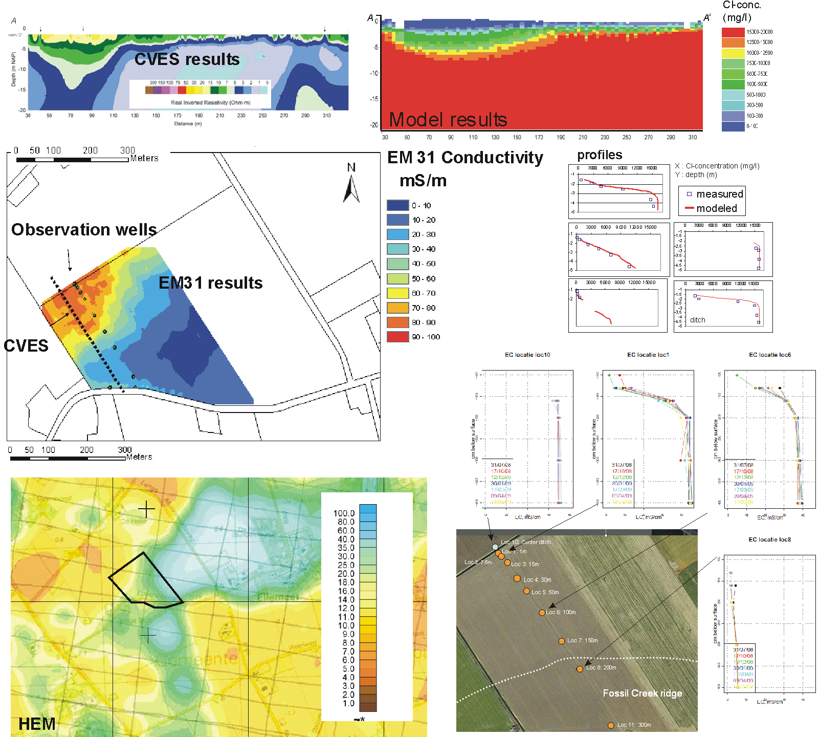 |
download Poster Texel congres
Information: gualbert.oudeessink@deltares.nl, perry.delouw@deltares.nl or jan.gunnink@tno.nl