The Global Flood Monitor maps the cities around the world which are suffering some kind of flooding based on news articles (see Figure 1 left). With a view to adding extra information for the current floods to the explorer, we added for those cities which are prone to riverine flooding, the current river flow conditions from our global hydrological forecasting system. These flow conditions (percentiles or categories based on the crossing of thresholds) are based on current runoff simulations from our global hydrological forecasting system GOFFIS (see Figure 1 right) and an analysis of past simulated runoff from the system for the last 34 years. The GLOFFIS system also forecasts river runoff for 1 to 14 days in advance based on external forecasts of precipitation for the entire world, with a resolution of 1 degree. The forecasted runoff conditions can therefore also be easily presented in the global explorer.

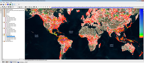
Figure 1. Global Flood Monitor (GFM), Flootags (left); and GLobal Flood Forecasting Information System (GLOFFIS), Deltares (right)