To protect Texel against coastline retreatment due to coastal erosion in the north-west corner
(Eierland) of the island, a dam was built to interrupt the littoral drift. To predict the morphological
development near the planned dam, the Dutch Ministry of Infrastructure and Environments has
done some research using morphological prediction models.
Directly after completion of the dam, it turned out that the physical development of the coastal
region was not similar to the prediction models. Note that the dam is located inside an outer tidal
delta. Strong flow velocity - and sediment transport gradients makes correct modelling of the
situation considerably complex.
After the remarkable observations of the Eierlandse morphodynamics, different parties have done
research again to figure out the basic mistakes they made in the previous predicting models. It
turned out that the numerical predicting models of the past (1990s) were not able to compute the
complex three-dimensional (3D) flow patterns in a proper way. Even after loads of available
validation data of the area, the researchers could not make a proper model that corresponded to
the physical reality.
In the last decades, the abilities of modelling software and computer power have increased
enormously. With highly developed three-dimensional modelling software, the morphodynamics of
Eierland is an interesting case again. In this study, the main focus will be on 3D modelling of the
morphodynamics of Eierland with the newest 3D software (Delft3D), and validate the model with
observed morphological development of the first couple of years after completion of the dam.
Hopefully some useful recommendations can be made with respect to future modelling of similar
cases.
Texel is one of the barrier Islands of the Wadden coastal system. To protect Texel against coastline retreatment due to coastal erosion in the north-west corner of the island(Eierland), a dam was built to interrupt the littoral drift perpendicular to the shoreline in 1995. To predict the morphological development near the planned dam, the Dutch Ministry of Infrastructure and Environments has done some research using morphological prediction models at the time (1993). Directly after completion of the dam, it turned out that the physical development of the coastal region was not similar to the prediction models. (Note that the dam is located inside an ebb tidal delta.) Strong flow velocity - and sediment transport gradients makes correct modelling of the situation considerably complex.
During a few weeks after completion of the dam, a relatively deep scour hole developed behind the dam tip and strong sedimentation occurred on downdrift side of the dam. Both were not expected. After these remarkable morphological observations, different parties have done research again to figure out the basic mistakes they made in the previous predicting models. Shortcomings of computational models were their main conclusions. In particular modelling of 3D flow-patters were rather complex.
In the last decades, the abilities of modelling software and computer power have increased enormously. With highly developed three-dimensional modelling software, the morphodynamics of Eierland is an interesting case again. During this study, the main focus will be on short term morphodynamics of Eierland. (Approximately the first five years after completion of the dam) Purpose of this thesis is to find out the responsible processes for the unexpected short term erosion- and sedimentation patterns around the Eierlandsedam.
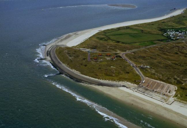
Figure 1. Eierland before dam construction. Year: 1990
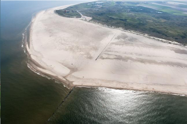
Figure 2. Eierland including the dam and clearly visible sediment accumulation around the dam. Year: 2011.
cases.
Info:
