WxS is short for the family of OGC Web <whatever> Services. The most well-known ones are:
- grids/maps: WMS on curvilinear model grids and WCS
- WMS primer Web Mapping Services: request map/grid graphics over the web.
- WCS primer Web Coverage Services: request map/grid data over the web.
- vectors/features
- WFS primer Web Feature Services: request vectors _graphics_over the web.
- WFS primer Web Feature Services: request vectors data over the web.
- WPS Web Processing Services: request remote processing of some kind calculation.
- WPS primer Web Processing Services: request remote processes for pre-defined calculations over the web using a web browser.
- CSW: catalogue service for the web
- CSW primer Catalogue Service for the Web; get a list of datasets from a csw instance.
- Preparing an ISO_13139 xml for filling a catalogue.
The OGC services can be read with GIS packages, but also with dedicated libraries, available per language:
- Python : OWSLib (python 3 support soon)
- Matlab has formal support for WMS only via wmsread. OpenEarth filled this gap by a family of implementations: wms, wcs and wfs (register first).
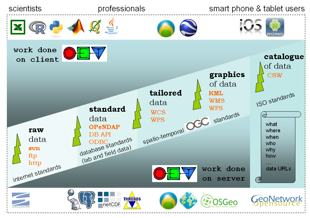
These WxS standards are an important part of the suite of layered standards OpenEarth identified. Wxs provides tailored data, graphics of data and catalogs of data. For the full user range they need to be accompanied though by standards for exchange of standard grid/vector data (netCDF-CF-OPeNDAP), relational data (PostgreSQL-PostGIS) and for raw data (subversion).