Deriving the Coastal Slopes of the World
The coastal zone has many important functions, especially since over 23% of the world's population lives there. With a view to Sea Level Rise the coastal zone is under increased interest. As researchers/engineers, we are interested in how the coastal zone behaves and how we can design solutions that will change the behaviour. An important parameter for coastal numerical models is the coastal slope. Since data is often scarce, we will have to deal with course and inaccurate data. With the launch of Google Earth Engine, a large database of satellite images has become available for analysing and this has enabled us to use satellite images to derive the coastal slopes.
Methodology:
- Detect shoreline for every single image
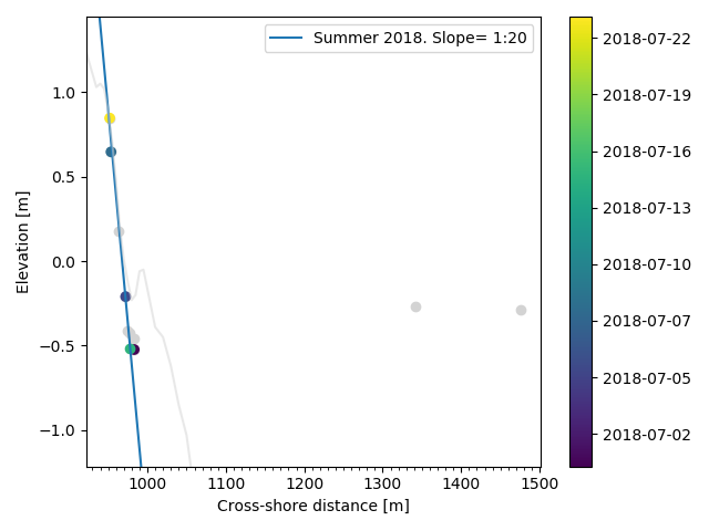
- Determine the cross-shore position of the shoreline for every transect
- Couple this to water level data to find the elevation of this point
- Combine multiple images (per transect) to find the intertidal slope
This is very much a work in progress. Current slope detection methods are very slow or require a fair amount of manual filtering of the images. The next step is to make a rough estimate of the sediment grain size.