...
| Code Block | ||||
|---|---|---|---|---|
| ||||
<geoMap>
            <geoDatum>WGS 1984</geoDatum>
            <projection>orthographic</projection>
            <defaultExtent id="NW">
                <left>-90</left>
                <right>5</right>
                <top>90</top>
                <bottom>0</bottom>
            </defaultExtent>
            <scaleBarVisible>true</scaleBarVisible>
            <northArrowVisible>true</northArrowVisible>
            <labelsVisible>true</labelsVisible>
            <backgroundColor>dark slate blue</backgroundColor>
            <esriShapeLayer id="World">
                <file>cntry98</file>
                <geoDatum>WGS 1984</geoDatum>
                <visible>true</visible>
                <lineColor>black</lineColor>
                <fillColor>dark olive green</fillColor>
            </esriShapeLayer>
            <gridLayer/>
            <esriShapeLayer id="World (overlay)">
                <file>cntry98</file>
                <geoDatum>WGS 1984</geoDatum>
                <visible>true</visible>
                <lineColor>black</lineColor>
                <opaquenessPercentage>0</opaquenessPercentage>
            </esriShapeLayer>
</geoMap> |
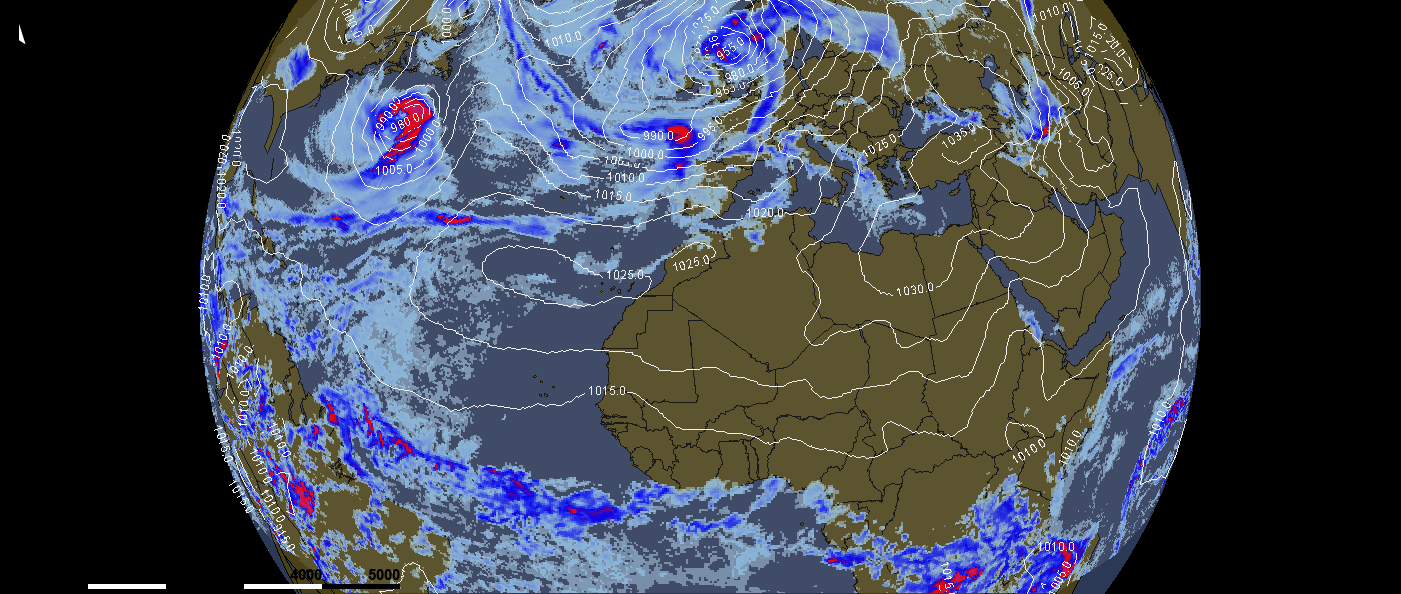
The above config example of using a orthographic projection will result in the below picture. In this picture the GFS precipitation forecast is combined with isolines of airpressure.