Introduction
The FEW Web Mapping Service with time support is the FEWS implementation of the WMS-T OGC standard and is available since 2018.02. It allows requesting images for plots that have been configured in the FEWS grid display. The WMS version that is supported is version 1.3.
Only the EPSG:3857 projection (WGS84 Web Mercator) is supported. Every gridPlot that has been configured in the grid display configuration represents a WMS layer.
WMS Request methods
The available request methods with their supported parameters are described here.
GetCapabilties
GetCapabilities: get the available layers and times available for each layer at the current system time.
GetMap
GetMap: Get the plot image as png for a layer for a requested time, image size and extent. Only untiled images are supported, which means the complete image has to be requested for the complete extent.
Request URL:
Supported parameters:
LAYERS (required): the layerId of the plot to display. Only one layerid is supported.
TIME (required): the time for which the grid has to be plotted. Only one time is supported. Time ranges are NOT supported.
WIDTH (optional): width of the image. Default is 800.
HEIGHT (optional): height of the image. Default is 600
VERSION (optional): supported version is 1.3 and is the default if not set. Older versions might work, but are not supported
CRS (required): the output projection of the plot. Only supported projection is: EPSG:3857
BBOX (required): the bounding box (in the projection as defined by the SRS parameter) of the extent that should be plot
Supported vendor parameters:
SHOWCONTOURS (optional): Display contour lines if enabled in the gridplot. Default is false. Set to true to show contour lines.
Restrictions:
The product of width and height is limited to the full HD resolution of 1920x1200 to avoid memory issues. In case a GetMap request is done where WIDTH*HEIGHT > 2304000 a bad request error will be returned.
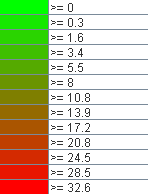
GetLegendGraphic
GetLegendGraphic: Get the legend image as png for a layer.
Properties
The following WMS specific properties can be configured in the FewsPiService.properties file.
WMS_BASE_URL: url that will be reported in the GetCapabilities response as URL to be used to request maps.
WMS_CLIENT_CACHE_TIMEOUT: Timeout of the cache in seconds, that is sent to the browser. default is 84600 seconds (one day). To disable caching, set the timeout to 0.
- WMS_ALLOWED_LAYER_IDS: List of all layer ids (comma separated) that have been made available in the WMS service. Be default all layers are available. it is advised to explicitly specify that the layers that should be available.
- WMS_IMAGE_MAX_WIDTH_HEIGHT: The maximum size of the WIDTH and HEIGHT product GetMap parameters. The default is set to 2304000 (the full HD resolution of 1920x1200). N.B.: The higher this value is set, the more memory is required to generated the WMS images.