| Table of Contents |
|---|
| Anchor | ||||
|---|---|---|---|---|
|
...
Setting up a flood mapping module within DELFT-FEWS is equivalent to creating a new model. As such, specific requirements are posed on data required in setting up the module, as well as some steps to make this data available to the module in the correct way.
| Anchor | ||||
|---|---|---|---|---|
|
...

| Anchor | ||||
|---|---|---|---|---|
|
| Anchor | ||||
|---|---|---|---|---|
|
...

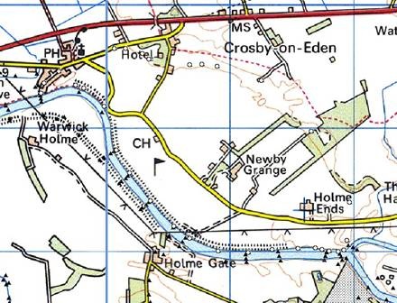
Figure 162 River axis map. These are indicated by the hatched surfaces.
TIFF background maps
Although not strictly used by the flood mapping module, TIFF layers of the reach at sufficient resolution (e.g. 1:10000, or 1:25000) arte required to check consistency of data and avoid problems such as positional errors etc.
| Anchor | ||||
|---|---|---|---|---|
|
...

Figure 164 Elements of the geoReference points configuration.
geoDatum
Coordinate system used in defining the points. For an enumeration of available coordinate systems see Appendix B.
geoReferenceData
Definition of a set of points falling in a particular section. For each of the sections (see above) the points to be considered when establishing the flood map for that section should be defined in separate groups.
...
Example of a set of geoReference points

| Anchor | ||||
|---|---|---|---|---|
|
...

Figure 165 Elements of the flood map module configuration
floodMapdirectories
Root element for definition of directories used in module
rootDir
Root directory for the module. All other directories can be defined relative to this root dir.
workDir
Working directory when running the module
outputDir
Output directory for resulting flood maps and publsished Interface FloodMap Stack file. This is the directory from which the General Adapter running the flood map should be configured to read the maps.
inputDir
Input directory for time series / longitudinal profile for which a flood map is to be calculated. This is the directory where the General Adapter running the flood map should be configured to write the data.
pcrDir
Optional location for PCRaster engine used in deriving flood maps. Required when using PC Raster executable (DLL is in the FEWS Bin directory). For 64 bit support the PCRaster engine needs to be installed manually. See: PCRaster
floodMapSet
Root element for the definition of activities to be run for the flood map module.

Figure 166 Elements of the flood map configuration
geoDatum
Definition of the coordinate system used in flood mapping. See Appendix B for enumeration of available options.
longitudinalProfile
Root element to be used when requesting output from the flood map module as a longitudinal profile.
branchFile
Published Interface formatted file with the calculation points to be included in the profile. Labels (id's) at the locations should co-incide with the labels (id's) in the time series.
timeSeriesFile
Time series inputs. These should be given for each location to be considered in the profile. Note this can be used either to create a profile for use in flood mapping in an ensuing step, or to create a profile for visualisation using the longitudinal profile display.
profileFile
Name of the output longitidunal profile. For each label where a match is found between the time series and the branch file data is retained in this output file.
floodExtentMap
Root element to be used when using the module to create a flood extent map.
input
Root element for defining inputs to flood extent map.

Figure 167 Elements of the configuration of inputs from the flood map.
profileFile
Name of the longitudinal profile file (Published Interface XML format) if this is used as an input (may have been created in the previous step). The labels in the profile file should coincide with the labels in the geoReference points file.
timeSeriesFile
Name of the time series file (Published Interface XML format) if this is used as an input. The labels in the time series file should coincide with the labels in the geoReference points file.
asciiDemFile
Name of the digital elevation model. This must be in the Arc-info ASCII grid format.
asciiAxisFile
Name of the axis file. This must be in the Arc-info ASCII grid format.
asciiMapSectionFile
Name of the map sections file. This must be in the Arc-info ASCII grid format.
geoReferenceFile
Name of the published Interface XML file with the geo-referenced point data.
interpolationOptions
Options to be used in interpolation. See the interpolation module (Module Configuration) for details. The flood map module should be defined to use bi-linear interpolation.unmigrated-wiki-markup
The options in this section should be set as; \[interpolationOptions\] \[interpolationOption\]bilinear\[/interpolationOption\] \[interpolationType\]seriesgeneration\[/interpolationType\] \[valueOption\]normal\[/valueOption\] \[/interpolationOptions\]
| No Format |
|---|
<interpolationOptions>
<interpolationOption>bilinear</interpolationOption>
<interpolationType>seriesgeneration</interpolationType>
<valueOption>normal</valueOption>
</interpolationOptions>
|
pcrScript
Name of the PC Raster (GIS) script to run when creating the flood maps. This item should be set as;
For PCRaster Script (Old Version)
| No Format |
|---|
<pcrScript>
	<pcrScriptFile>pcr_flood_clump.mod</pcrScriptFile>
</pcrScript>
|
See attached pcr_flood_clump.mod
For PCRaster XML Script (PCRaster 2008 Version compatible)
| No Format |
|---|
<pcrScript>
	<pcrScriptXMLFile>pcrscript.xml</pcrScriptXMLFile
</pcrScript>
|
See attached pcrscript.xml Wiki Markup
output
Root element for definition of the required output. Different output options may be selected. Multiple options may also be defined.

Figure 168 Elements of the flood map output configuration
outputOption
Definition of an outpus block, requesting the flood map module to return the given output type. Enumaration of available options includes;
...