Here is the documentation of Nourishments dataset.
Nourishment data in OpenEarth:
The dataset of nourishments along the Dutch coast is available from 1952 until today (2014). nourishments.nc has two different data structures:
1-Dimensional arrays based on the list of nourishments along the Dutch coast, as provided by Rijkswaterstaat
n_code (<String>)
date (<Float64>) stretch (<Float64>) kustvak (<String>) location (<String>)
... type (<String>) vol (<Float64>) [nourishment = 394] [nourishment = 394][bounds = 2] [nourishment = 394][bounds = 2] [nourishment = 394] [nourishment = 394] [nourishment = 394] [nourishment = 394] 3-Dimensional matrices based on transects, time and type. The data structure is similar to the JarKus dataset concerning the alongshore dimension, although it contains data from 1952 until now and it distinguishes among four main nourishment types. More information here.
Volume (<Float64>)
Time_start (<Float64>) Time_end (<Float64>) [alongshore = 2268][n_time = 62][type_flag_def = 4] [alongshore = 2268][n_time = 62][type_flag_def = 4] [alongshore = 2268][n_time = 62][type_flag_def = 4] 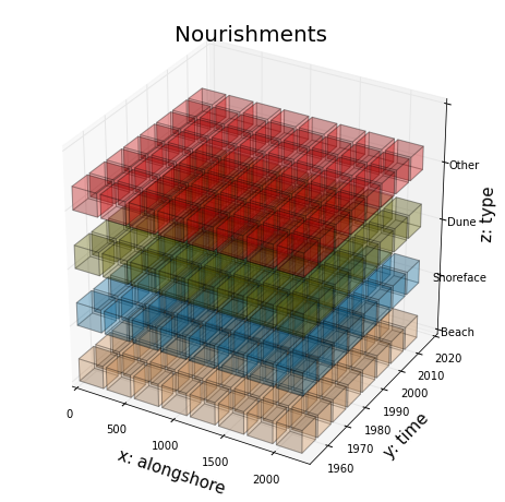
Data flow is summarized as:
- Raw data + scripts (ascii + Matlab/Python)
- Raw ascii data + Matlab/Python tools for conversion to netCDF
https://svn.oss.deltares.nl/repos/openearthrawdata/trunk/rijkswaterstaat/suppleties/ (register at oss.deltares.nl)
- Raw ascii data + Matlab/Python tools for conversion to netCDF
- Standardized data (netCDF on OPeNDAP)
- Visualized data (kml)
TODO: Better compliancy with CF
See also: